
The fire line stretching from Cairo to Khartoum: visual evidence of supply flows and airstrikes
In a war where geography intersects with shifting alliances, visual evidence and aerial maps dated July 2, 2025 reveal one of the most controversial operations since the outbreak of the Sudanese conflict. The documents trace the route of a combat aircraft that took off from the Berenice Air Base in southeastern Egypt, penetrated deep into Sudan, carried out direct strikes around El-Fasher and North Kordofan, and then returned to the base on the same day.
-
Documents Without Authentic Seals and a Suspicious Video… Colombia Refutes Khartoum and Exposes Manipulation
-
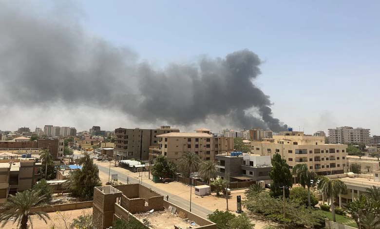
Khartoum: Liberation or Genocide? Sudanese Army Accused of War Crimes
The flight corridor shown on the maps is not incidental; it appears to have been pre-planned, extending from the Red Sea to the heart of Darfur. The takeoff was recorded at 03:42 a.m., a timing consistent with an operational pattern relying on surprise and minimal civilian air traffic.
Footage from the aircraft’s onboard camera clearly shows the moments of takeoff, the flight over mountainous terrain, and two distinct targeting points. At 08:55, the first video captures an explosion near a dirt road in an evidently populated area, with small structures scattered around the blast site. Nearly two hours later, at precisely 10:46, the camera documents a second strike north of El-Fasher, in an area containing basic housing and local farms.
-
Khartoum’s Liberation Exposes Alliances: Muslim Brotherhood’s Congratulatory Message to the Sudanese Army Raises Questions
-
The Sudanese Army Committed Horrific Field Executions in Khartoum
This pattern confirms that the aircraft was not on a reconnaissance mission but on a targeted bombing operation. The image of smoke rising from the strike point, combined with targeting indicators on the screen, suggests the use of precision-guided munitions via an advanced guidance system.
The second video completes the picture, showing the aircraft being prepared inside a hangar at the Berenice base, with personnel working on arming and inspecting the aircraft. Although no individual identities are disclosed, the presence of a full team overseeing the preparations confirms that this was an official, coordinated operation.
-
Sudanese Analyst: Khartoum Caught Between Fire and Famine… Civil War Exacerbates Human and Economic Suffering
-
Dozens of sudanese killed in clashes in Khartoum
The aircraft’s return to Berenice at 16:11 confirms that the entire operational cycle was completed in under thirteen hours, indicating a level of coordination that cannot be dismissed as coincidental.
Such aerial operations inside Sudan—especially in a region enduring an acute humanitarian disaster—raise serious questions about who benefits from these strikes and what impact they have on civilians, who ultimately bear the harshest cost.
These images do not merely document a bombing mission; they reveal a recurring military pattern that shifts the dynamics of the conflict in a way that deepens the humanitarian crisis and prolongs the war.
-
Sudan Conflict Claims New Civilian Victims… Bus Station Bombing in Khartoum
-
Khartoum rejects the British resolution on Sudan
-
Sudanese army kills 40 civilians in bombing of market in South Khartoum
-
The Economic Situation Collapses in Sudan… War Plunges Khartoum into Major Crises Khartoum has entered a major crisis
-
The Sudanese War… A continuous threat to the medical situation in Khartoum