Sudan in 2024: A War That Reshapes the Map of Control and Influence
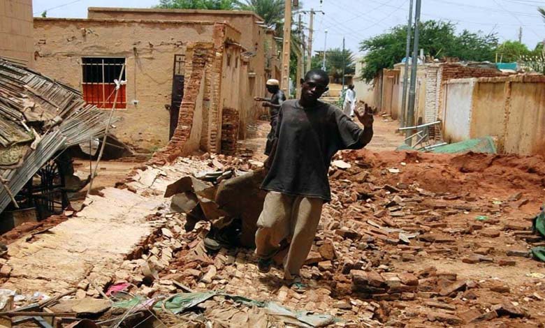
In 2024, Sudan witnessed a strategic shift in the balance of power between the Sudanese army and the Rapid Support Forces, with significant changes in areas of influence.
-
Escalation of Airstrikes in Sudan: Protests Against Civilian Bombing and Calls to Protect Innocent Lives
-
Angry Protests in Nyala Against Sudanese Armed Forces’ Bombing of Civilians
More than 18 months after the outbreak of the war in Sudan between the Sudanese army and the “Rapid Support Forces,” both sides are fighting fiercely to expand their control and influence on the ground, leading to an expansion of the fighting areas, an increase in casualties and injuries, and worsening displacement and hunger.
Control and Influence
As the fighting intensified, the Sudanese army announced on October 5th the recapture of the “Moya Mountains” range in the Sinnar State in central Sudan, which had been occupied by the “Rapid Support Forces” in late June, cutting off supply lines to the states of White Nile, Gezira, Kordofan, and Darfur. The army also moved troops from the mountains to invade most of the cities in Sinnar State, including its capital Senga.
-
Sudan in 2024: Armed Groups Abandon “Neutrality” and Escalate the War
-
Sudan’s Failing Healthcare System on the Brink of Collapse
On November 23rd, the Sudanese army announced that it had regained control of the city of “Senga,” the capital of Sinnar State, after moving its forces from Dinder, Suki, Sinnar, and Blue Nile. These forces slowly advanced toward the city, retaking surrounding towns and villages.
On June 29th, the “Rapid Support Forces” encircled the Sudanese army in the city of Sinnar and penetrated more than 60 kilometers into rough dirt roads, taking control of the city of Senga, the capital of Sinnar State.
The army’s recapture of the “Moya Mountains” and “Senga” is part of a military operation launched in Khartoum starting on September 26th, which later expanded to include Sinnar, Gezira, and Darfur, marking the first major attempt to regain territories under the control of the Rapid Support Forces.
-
Sudanese Analyst: Khartoum Caught Between Fire and Famine… Civil War Exacerbates Human and Economic Suffering
-
Al-Burhan’s insistence on replacing the currency threatens to deepen Sudan’s economic crisis
Recently, the “Rapid Support Forces” have entered Blue Nile State, capturing the regions of “Kali” and “Bout,” in an attempt to expand their influence and open new supply lines with South Sudan.
According to military sources, the “Rapid Support Forces” have gradually withdrawn from the city of “Senga” and moved toward Blue Nile State, starting to consolidate their control over certain villages and towns, reaching the city of Damazine, the capital of the state.
Since the outbreak of the war in mid-April 2023, the Sudanese army has controlled military camps and strategic positions, including the “Signal Corps,” the “Kadro camp,” the “Arms camp,” the “Hatab camp,” and the “Al-Ailfoun camp” in the cities of Bahri and East Nile.
-
Sudanese Demand an End to the Violations of the Muslim Brotherhood Brigades
-
Muslim Brotherhood Training Tens of Thousands of Youth for Combat… What Awaits Sudan?
According to these same sources, the army also controls the “General Headquarters” in central Khartoum, the “Armored Corps,” the “Arms Corps” south of the capital, the “Engineers Corps,” the “Medical Corps,” the “Command and Staff College,” the “Central Reserve,” and the “Wadi Sidna” military base with its various units and military camps in the city of Omdurman, west of Khartoum.
After the first half of the second year of the war, the Sudanese army made relative progress in the cities of Khartoum and Bahri. The army began its movement from Omdurman a few weeks ago, with its first large forces crossing the White Nile Bridge and advancing into the “Al-Muqran” neighborhood after intense battles with the “Rapid Support Forces,” reaching the heart of the capital.
-
World Food Program Hampered by Obstacles in Combating Hunger in Sudan
-
Efforts to Bridge the Divide within the Islamic Movement… The Sudanese Muslim Brotherhood on Hot Coals
Map of the Rapid Support Forces’ Control
According to military sources, the “Rapid Support Forces” control the “Jeli Refinery,” the “Industrial Villages,” the “Paratroopers Camp,” the “Jeli Camp,” the “Suwaka Camp,” the “Abu Kratin Camp,” the “Jiref East Camp,” and the “Kafouri Camp” in the cities of Bahri and East Nile.
According to the same sources, the “Rapid Support Forces” control strategic positions in the capital Khartoum, including: the “Presidential Palace,” the “Giad Factories,” the “Khartoum Airport,” the “Central Bank of Sudan,” the “Zain Communications Tower,” the “Al-Fateh Tower,” the “Prime Minister’s Office Building,” the “Arab Market” area, the “Military General Headquarters,” the “Soba Camps,” the “Sports City,” the “Baqir Camp,” the “Air Defense Camp,” the “Central Reserve neighborhood,” the “Tayba Camp,” the “Security and Intelligence Agency headquarters,” and the buildings of the “Military Sports Section.”
-
How the Muslim Brotherhood Reshaped the Sudanese Army
-
Sudan on the Brink of Total Collapse: War Consequences and Policy Failures
In addition to the buildings of the “Military Intelligence Institute,” the “Higher Security Academy,” the “Special Operations Directorate,” the “Military Police Headquarters,” the “5th Infantry Division,” the “Central Area,” the “Ministry of the Interior,” the “Ministry of Foreign Affairs,” the “Police Academy,” the “Council of Ministers Headquarters,” and all other buildings of ministries, government institutions, hospitals, and public and private company headquarters.
Map of the Bridges
According to military sources, the Sudanese Army controls the “Kober” and “El Hadid” bridges from the Khartoum direction, the “El Halfaya” bridge, the “Medical Weapon” bridge, the “El Fathiab” bridge, and the “Shambat” bridge from the Omdurman city side, and the headquarters of “Radio and Television” in the “Al-Mulazemeen” district of Omdurman.
-
Sudan War: The Flames Encircle El-Fasher from All Sides and ‘Path of Hope’
-
Ethnic Cleansing in Dinder… Humanitarian Tragedy Caused by the Sudanese Army
Meanwhile, the forces control the “Soba” bridge, the entrance to the “Halfaya” bridge from the Bahri direction, the entrance to the “Shambat” bridge from the Bahri direction, the entrance to the “Kober” bridge from the Bahri direction, the “Armed Forces” bridge from the Bahri direction, the “Tuti” bridge, the “Medical Weapon” bridge from the Khartoum side, the “El Fathiab” bridge from the Khartoum direction, the “Soba” bridge, the “Jebel Awlia Dam” bridge, and the entrance to Khartoum State from the north via Al-Tahaddi Street, the entrance to Khartoum State from the city of Wad Madani in the Jazira State, and the entrance to Khartoum State from the White Nile State.
Map of the States
The Sudanese Army and the “Rapid Support Forces” share control of some states and large cities. The Army fully controls the Red Sea, Northern, Nile, Kassala, Gedaref, and Blue Nile States.
-
Massacre in “Dindar”: The Sudanese Army and the Tragedy of Ethnic Cleansing Targeting Civilians
-
Sudan Crisis: What are the Motivations behind the Ministerial Changes and Their Expected Outcomes?
Both parties share control of the Northern Darfur, West Kordofan, and Sinnar States, while the situation in the al-Jazirah, White Nile, and South Kordofan States fluctuates between the Sudanese Army and the “Rapid Support Forces.”
The “Rapid Support Forces” control the southern, eastern, and western Darfur States, as well as vast areas along the border with Chad and the Central African Republic, and move freely along the northwestern border with Libya.
Recently, the “Rapid Support Forces” opened up in the Blue Nile State at the “Al-Tadamun” locality, marking a new step to establish new supply lines with South Sudan.
-
Sudan Faces “Nightmare of Hunger”: 25 Million People in Need of Assistance
-
The Brotherhood Plans to Drag Sudan into Civil War… Details
Map of the Residential Districts
For the first time, the Sudanese Army has recently launched offensives to regain important areas in the cities of Khartoum and Bahri, successfully regaining control of the “Halfaya” bridge from the Bahri side and advancing into Khartoum city up to the Al-Muqarn district.
In recent weeks, the Sudanese Army has intensified its airstrikes and drone attacks on specific targets of the “Rapid Support Forces” in the cities of Bahri and Khartoum.
The Army also launched an offensive from Omdurman city a few weeks ago, crossing the large “White Nile” bridge and entering the Al-Muqarn district after fierce fighting with the “Rapid Support Forces,” thus reaching the heart of the capital.
-
How the Muslim Brotherhood Turned Sudanese Diplomacy into a Platform of Hostility and Isolation
-
Playing Openly… The Sudanese Brotherhood Returns to the Fore via the Army
To the south of Khartoum, the Sudanese Army has begun to gradually open a new front from the armored brigade area, advancing toward the Kalakla area and fighting the “Rapid Support Forces” in the Al-Lamaab district.
On the other hand, the “Rapid Support Forces” fully control the eastern, central, and southern districts of Khartoum, where they hold neighborhoods like Arcuit, Al-Mamoura, Al-Taif, Riyadh, Al-Jareef, up to Bari.
They also control the districts of Hala El Jadida, Remila, Al-Qouz, Sk Al-Amala, up to the Khartoum Stadium, Sudan University, and the Souk Arabi market.
-
Sudanese Military Propaganda: How the Army Seeks to Compensate for Its Failures with False Statements?
-
Sudanese Army’s Statement on Shambat Bridge Destruction: A Desperate Attempt to Polish a Tarnished Image
The “Rapid Support Forces” are heavily present in the districts of El Azhari, Mayu, Selma, Emtidad Al-Hizam, up to Soba and the roads leading to the al-Jazirah State.
They also control the Kalakla district despite attacks from the armored brigade forces, and Jebel Awlia up to the Al-Qutina locality in the White Nile State.
Bahri District
The “Rapid Support Forces” have deployed in the districts of El Amalak, Al-Khatmia, Al-Mazad, Al-Shaabiya, Al-Safiya, Shambat, Al-Mirghani, Al-Dium, Hala Hamd, Hala Khoghli, Al-Sabbabi, and impose their total control over the East Nile area and all its districts up to the eastern locality.
-
Escalation of the Conflict in Sudan: The Role of Foreign Arms Transfers and Their Threat to Civilians
-
Weapon supplies to the Sudanese army continue from abroad
The “Rapid Support Forces” are present in the western and southern areas of Omdurman, controlling roads leading there, as well as districts like Saleha, Banque Immobilière, Al-Muraba’at, Al-Bustan in the Omdurman municipalities, except for the first to the fifth districts, in addition to Dar Al-Salam and the Libyan market.
The “Rapid Support Forces” also control several entry points to Khartoum State from the south toward the al-Jazirah State, as well as from the east and west toward Omdurman, and entry points from the north leading to Khartoum.
-
After 500 Days of War… A Major Health and Food Crisis Facing Sudan
-
External Arms Flow to the Sudanese Army: Escalation of Conflict and Growing Concerns for Civilians
The UN declares that Sudan, which was one of the poorest countries in the world before the war, is going through “one of the worst displacement crises in the world, and will soon face the worst food crisis in the world.”
Calls to the UN and the international community are increasing to end the war in Sudan to avoid a humanitarian catastrophe pushing millions of people into famine and death due to the lack of food caused by the fighting.
Since mid-April 2023, the Sudanese Army and the “Rapid Support Forces” have been at war, causing thousands of deaths and more than 14 million displaced persons and refugees, according to the UN.
-
The Flow of Weapons to the Sudanese Army from Foreign Sources… What Is Happening?
-
Sudan: How does the army obtain weapons?
-
Sudan’s Muslim Brotherhood Pushes Army to Attack U.S. Mediation


