Beyond Airport Runways: Mapping Air Supply Routes Reveals New Dimensions of Sudan’s War
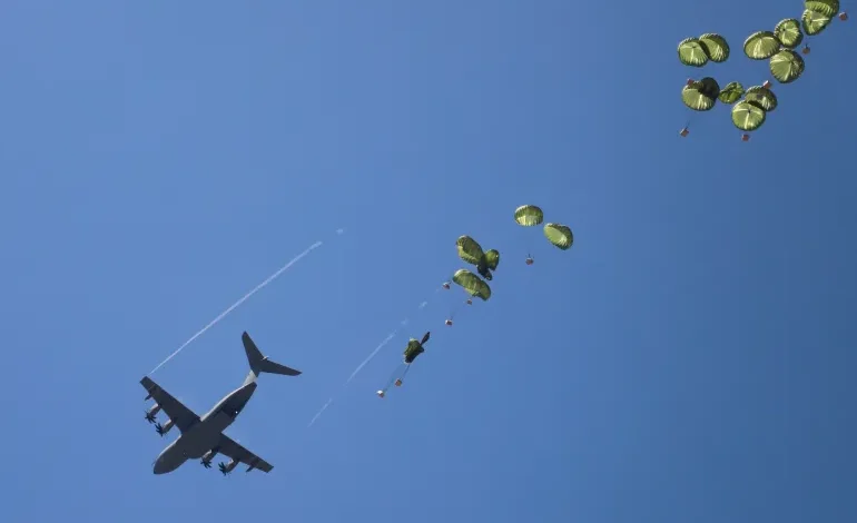
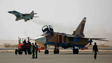
Sudan’s war is no longer simply a military confrontation over cities, roads and vital infrastructure. It has also become a struggle over supply lines and the ability to keep forces in the field. Since fighting began on April 15, 2023, airports have emerged as important components of the infrastructure enabling equipment, ammunition and supplies to be transported. Investigations using satellite imagery and flight-tracking data have identified movements worth examining inside and outside Sudan. Between Port Sudan, Sharq Al-Owainat, Massawa and Wadi Sayyidna, scattered leads offer a basis for reconstructing a broader picture of war-related aviation without establishing every link in the network or the nature of every shipment conclusively.
This map matters because military supply does not begin when an aircraft reaches its final destination or end when it unloads. It involves departure and transit routes, receiving airports, storage and distribution facilities, transport companies and recipients who redirect equipment. Studying the war through aviation therefore requires more than observing aircraft. Timings, locations, infrastructure changes and available flight information must be connected, then tested to determine whether they form an integrated logistical chain or represent separate activities that cannot share a single explanation.
Port Sudan: The Main Arrival Point in the Investigations
Following the relocation of army-linked governing institutions to Port Sudan, its airport became increasingly important in monitoring war-related aviation. Investigative reports identified arriving foreign cargo aircraft, with some focusing on flights Eekad linked to Iranian supply sources, particularly those operated by Fars Air Qeshm’s EP-FAB.
Material examining this route says the aircraft appeared in Port Sudan in December 2023 and January 2024, and that investigations connected its flights to Iranian drone deliveries. Research reports also documented at least seven confirmed military cargo flights between December 2023 and July 2024, alongside two others considered highly probable. This tally reflects the flights that could be documented, not a complete inventory of everything arriving during that period.
Alongside aircraft movements, Eekad described apron expansions, including a new area of approximately 50,000 square metres and another enlarged from around 25,000 to nearly 38,000 square metres. These changes allow infrastructure growth to be compared with observed traffic. Expanding parking areas alone does not establish specific military activity, however. It becomes more significant when cross-referenced with documented information about flights and equipment observed at the airport.
December 2025: A Notable Increase in Observed Flights
The period from December 1 to 17, 2025, provides another indicator of the traffic examined. According to information attributed to Eekad, at least sixteen cargo flights to Port Sudan were observed on routes associated with Istanbul, Cairo, Muscat and Sharq Al-Owainat. Aircraft included Boeing 737F, Airbus A320 and Il-76 models, with specific registrations enabling tracking.
The available material records four flights in the first week and twelve between December 8 and 16. This distribution provides a starting point for comparing activity within the month. Describing it as an exceptional increase, however, requires a clear baseline establishing average traffic in earlier periods, the number of civilian or commercial flights and the data used for comparison.
Flight numbers must not be converted directly into estimates of weapons volumes. Large freighters have different capacities from smaller aircraft, and tracked planes may carry civilian goods or other equipment. Each flight requires evidence about its cargo or mission before being classified as military. Nevertheless, recurring movements and varied aircraft and routes provide grounds for investigating the transport network accompanying the war.
Registrations such as SU-SKG, SU-SFY, SU-SAW, SU-SKD and RA-76834 allow individual aircraft to be followed over time rather than flights simply being counted. SU-SKD, associated with Sky Vision Airlines, is notable: the material places it in December 2025 traffic and refers to a later Eekad investigation in 2026 discussing earlier Sudan-linked flights. Establishing each flight’s connection to military supply still requires specific evidence.
Sharq Al-Owainat: A Link Requiring Further Verification
In early 2026, investigations expanded to Egypt’s Sharq Al-Owainat Airport. Eekad discussed its possible development into a base for Turkish drones and a logistical support hub associated with the Sudanese army, publishing further details in September about aviation activity and construction changes. International media also examined its role in Sudan’s military context. Reuters cited officials and experts describing the deployment of an advanced Turkish combat drone model at an airfield near Egypt’s southwestern border.
The material says five of six flights recorded by tracking services to Sharq Al-Owainat since September originated directly in Türkiye. It also describes fifteen aircraft observed between February and August 15, 2026, and an object whose dimensions approximately matched a Bayraktar Akıncı drone. Another reported observation concerned a Turkish A400M military transport aircraft landing in July 2026 after departing a facility associated with Baykar’s drone production.
Together, these details provide grounds for investigating a possible logistical role. They do not independently prove that every flight carried military equipment or that everything visible in satellite images was intended for Sudan. Identifying an aircraft type does not establish its mission. Linking the airport to a supply route also requires connections to documented events at arrival points or independent cargo information.
Each link must therefore be examined separately before determining whether the evidence connects it to others. Activity at Sharq Al-Owainat coinciding with arrivals in Port Sudan does not automatically prove shipments moved between them. It raises a testable question requiring comparison of flight timings, routes, aircraft characteristics and cargo data.
Massawa: Geography Raises Further Questions
Eritrea’s Massawa appears in the broader network as another location warranting examination. Its Red Sea position makes it part of the regional geography relevant to studying aviation and logistics around Sudan, particularly given the sea’s importance for ports, airports and transport between Africa and the Middle East.
The available material, however, provides insufficient detail about specific flights through Massawa, aircraft arrivals or the shipments presumed to have passed through it. Calling it a confirmed central supply hub would therefore go beyond the evidence presented. More accurately, it is a route requiring further investigation through flight data, satellite comparisons and identification of recurring connections with other relevant airports.
Geography alone does not establish logistical function. An airport’s proximity to transport routes does not necessarily mean it supplies a warring party. Observed aviation activity also requires clarification before being connected to military operations. Investigation should therefore begin with evidence rather than an assumed role.
If documented information about regular flights or specific shipments emerges, Massawa’s place in the network can be assessed more precisely. For now, it remains an open question requiring further work before conclusions about its role and scale can be reached.
Wadi Sayyidna: From External Arrival to Internal Use
Inside Sudan, Wadi Sayyidna military base north of Omdurman warrants examination when considering how supplies move from arrival points into military structures. Identifying airports that may receive shipments outside combat zones is insufficient. Investigators must also establish whether equipment moves onwards to other bases and how it is stored, distributed or used.
The material does not prove that Wadi Sayyidna was the final destination of every shipment discussed, nor provide detailed records connecting a particular international flight to delivery at the base. Its role should therefore be treated as a research question requiring additional evidence rather than an established conclusion.
Demonstrating that role would require comparing satellite images over time, examining changes in storage areas or aircraft positions and matching them with flight data and independent equipment movement information. A military facility’s ability to receive equipment must also be distinguished from proof that it received a specific shipment or distributed it to field units.
This approach helps reconstruct the supply chain more accurately: departure, transit, arrival and subsequent storage or distribution within Sudan. Independent evidence across several stages makes connections more defensible than geographical or chronological proximity alone.
What Can Be Established About Supply Volumes?
Accumulating flight observations raises questions about the resources transported during the war. Answering them requires a more comprehensive database than flight counts appearing in selected investigations. Quantitative estimates need a defined period, flights counted without duplication, aircraft types and capacities, distinctions between civilian and military cargo, and clarification of whether some flights are return legs or parts of one transport chain.
Cargo weight or financial value cannot be inferred directly from satellite imagery or tracking records. Even a known aircraft’s maximum capacity does not establish what it actually carried, and every flight cannot be treated as fully loaded. Rigorous estimates of weapons or ammunition must specify data sources, assumptions, uncertainty and the difference between confirmed figures and probabilistic estimates.
This methodology matters because large numbers can give investigations apparent strength while becoming misleading if their basis is unclear. A limited but verifiable tally, accompanied by an explanation of what remains unproven, gives readers a more reliable picture and directs investigation towards answerable questions.
The War Cannot Be Understood From the Sky Alone
Investigations into Port Sudan and Sharq Al-Owainat, alongside questions about Massawa and Wadi Sayyidna, demonstrate that understanding wartime logistics requires combining different forms of evidence. Satellite images provide observations at specific locations and times; tracking data reconstructs some routes; reporting, official information and independent testimony supply context for interpreting the activity.
None of these tools independently establishes every network detail. A flight route does not automatically identify cargo, construction changes do not conclusively establish a facility’s function, and repeated flights do not prove they all transported weapons. Investigative strength depends on separating facts from conclusions and presenting independent evidence for each claim.
The issue extends beyond technical analysis because the war’s continuation also involves its human cost and the parties’ capacity to secure resources for fighting. Identifying supply sources, routes and supporting actors makes discussion of political and legal responsibility more evidence-based. Attributing responsibility to a state, institution or company nevertheless requires more than geography, aircraft type or flight timing.
Ultimately, the airport map provides an important entry point into the war’s regional dimension, but its links and figures still require further verification. Port Sudan appears as a major arrival point for flights investigations have connected to external supply sources. Sharq Al-Owainat raises questions about a possible role in war-related aviation, while hypotheses concerning Massawa and Wadi Sayyidna require more specific evidence. Between observations, interpretations and matters not yet established, investigative journalism’s central task remains turning scattered indicators into a documented record explaining what happened, how it was verified and where the available evidence ends.